on this page
-
Markets
-
Services

Clark Barlow
Technical Manager II, Water Resources West, Henderson, Nevada, USA contact form+1 702 605 9069
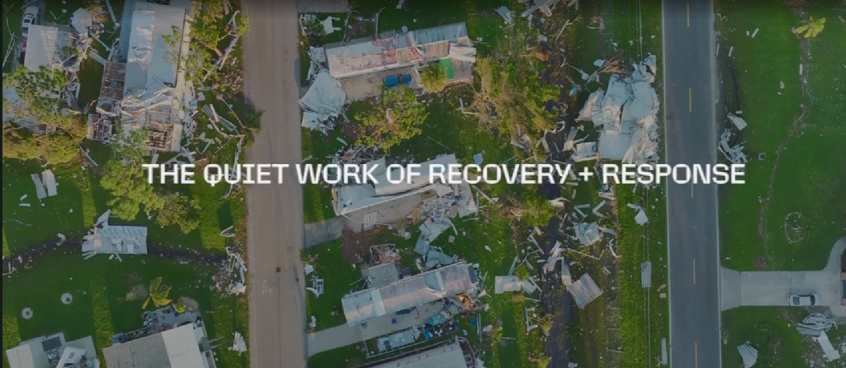
The Federal Emergency Management Agency (FEMA) is known for its administration of the National Flood Insurance Program and associated Flood Insurance Rate Maps. While they identify areas where flood insurance is required and help keep new development from exacerbating flood problems, they do little to solve existing flood risk before a disaster occurs.
It makes sense. Mapping a flood hazard is only the first step in understanding and mitigating the associated risk. A community wanting to become more flood resilient faces numerous hurdles: funding, politics, technical expertise, stakeholder support—to name a few. What if we could remove barriers, empower communities and give them the tools to solve flooding issues on their own?
In Region 9, which includes Hawaii, California, Nevada and Arizona, FEMA conducted a new pilot project using resilience planning support funds. The goal was determining what data and processes could be leveraged as communities engage in resilience planning in the face of sea level rise and existing flood risk. This would be accomplished by partnering with a local community impacted by flooding and working together to develop and prioritize an actionable area drainage plan to address flooding issues. For the action plan to be useful to the community, it needed to:
- Provide a detailed understanding of the location, cause, and extent of flooding
- Identify actionable flood resilience opportunities
- Include a detailed Benefit-Cost Analysis
- Use stakeholder-driven scoring criteria to prioritize alternatives
For Region 9, the City and County of Honolulu (CCH) was a perfect partner. The low-lying Mapunapuna Industrial Area, built on top of old fishponds, has been plagued by flooding for years. The nearby Moanalua and Kalihi Streams run through economically critical areas and have a recent history of overtopping their banks. Other areas are prone to localized flooding due to a lack of storm drain infrastructure, and rising sea levels represent another threat, not just for the Mapunapuna area, but for other coastal areas around Hawaii.
In June 2021, Region 9 contracted with Strategic Alliance for Risk Reduction (STARR II) to deliver the project. FEMA and CCH made their objectives clear from the beginning. For FEMA, it was engaging local stakeholders. For CCH, it was ensuring the plan was “actionable” and not just an informative report.
The first step was better understanding existing flood risk. A holistic watershed approach was used to analyze flooding from all possible sources including storm drain, riverine, tidal and pluvial. Hydrologic models were then developed to determine hypothetical flowrates. A coupled 1D/2D hydraulic model was developed incorporating storm drains, river hydraulics, tidal boundary conditions including sea level rise and localized flooding using a rain-on-grid approach. The result was a comprehensive issues map enabling CCH to see their flood risk in a way they never could before.
The next step was identifying actionable resilience opportunities. Knowing options would be prioritized and scored based on stakeholder-driven criteria, it was important to develop and understand the criteria before recommending ideas for selection. Conceptual alternatives were created based on a comprehensive list of possible scoring criteria, including environmental benefits, impact to underrepresented communities, protecting against largest losses, minimizing permit requirements and more. These criteria were presented in a day-long workshop with technical stakeholders to gather feedback on which criteria mattered most to them. This feedback helped narrow down the list of alternatives to those the community would most likely accept.
Once mitigation alternatives were developed, cost-benefit analyses were performed. To make the study as “actionable” as possible, BCAs were developed in compliance with FEMA grant applications. This enhancement enabled the study to be used as a turnkey grant application, should CCH wish to pursue grant funding for the mitigation projects in the future. In addition, the community was equally interested in learning about scenarios that were not viable from a cost-benefit perspective as they were about alternatives where the cost benefit was high.
Mitigation alternatives were further prioritized by evaluating and scoring their alignment with finalized stakeholder-driven criteria. A prioritization tool was developed to allow CCH to adjust the weights and scoring of different criteria in response to future community engagement and feedback. Current Honolulu floodplain ordinances were also reviewed and recommendations made to limit future development from exacerbating flood risk in the project area.
By the time the study was completed in May 2024, it had empowered the community in several ways because they now had:
- A comprehensive understanding of the cause, location and extent of flooding
- A prioritized list of actionable flood mitigation options that aligned with stakeholder preferences
- A FEMA-compliant BCA for each alternative that could be used to apply for further grant funding
- A list of recommended changes to local floodplain ordinances that would improve resiliency against flooding
The response from FEMA and the community was positive, and requests to perform similar studies came almost immediately. The path to resilience is still long, with project funding, detailed analysis, aerial topography, geotechnical analysis, permitting, right-of-way, plan development, constructability, utility conflicts and construction of a mitigation project needing to be completed. While the hope is the community implements recommended mitigation projects, the empowerment they feel to solve flooding issues may be the most important benefit of all.
This article was originally published in the November 2024 issue of the Floodplain Management Association's quarterly newsletter, "The High Water Mark."
Please note that you are now leaving the AtkinsRéalis website (legal name: AtkinsRéalis Group inc.) and entering a website maintained by a third party (the "External Website") and that you do so at your own risk.
AtkinsRéalis has no control over the External Website, any data or other content contained therein or any additional linked websites. The link to the External Website is provided for convenience purposes only. By clicking "Accept" you acknowledge and agree that AtkinsRéalis is not responsible, and does not accept or assume any responsibility or liability whatsoever for the data protection policy, the content, the data or the technical operation of the External Website and/or any linked websites and that AtkinsRéalis is not liable for the terms and conditions (or terms of use) of the External Website. Further, you acknowledge and agree that you assume all risks resulting from entering and/or using the External Website and/or any linked websites.
BY ENTERING THE EXTERNAL WEBSITE, YOU ALSO ACKNOWLEDGE AND AGREE THAT YOU COMPLETELY AND IRREVOCABLY WAIVE ANY AND ALL RIGHTS AND CLAIMS AGAINST ATKINSRÉALIS, AND RELEASE, DISCHARGE, INDEMNIFY AND HOLD HARMLESS ATKINSRÉALIS, ITS OFFICERS, EMPLOYEES, DIRECTORS AND AGENTS FROM ANY AND ALL LIABILITY INCLUDING BUT NOT LIMITED TO LIABILITY FOR LOSS, DAMAGES, EXPENSES AND COSTS ARISING OUT OF OR IN CONNECTION WITH ENTERING AND/OR USING THE EXTERNAL WEBSITE AND/OR ANY LINKED WEBSITES AND ANY DATA AND/OR CONTENT CONTAINED THEREIN.
Such waiver and release specifically includes, without limitation, any and all rights and claims pertaining to reliance on the data or content of the External Website, or claims pertaining to the processing of personal data, including but not limited to any rights under any applicable data protection statute. You also recognize by clicking “Accept” that the terms of this disclaimer are reasonable.
The information provided by Virtua Research cited herein is provided “as is” and “as available” without warranty of any kind. Use of any Virtua Research data is at a user’s own risk and Virtua Research disclaims any liability for use of the Virtua Research data. Although the information is obtained or compiled from reliable sources Virtua Research neither can nor does guarantee or make any representation or warranty, either express or implied, as to the accuracy, validity, sequence, timeliness, completeness or continued availability of any information or data, including third-party content, made available herein. In no event shall Virtua Research be liable for any decision made or action or inaction taken in reliance on any information or data, including third-party content. Virtua Research further explicitly disclaims, to the fullest extent permitted by applicable law, any warranty of any kind, whether express or implied, including warranties of merchantability, fitness for a particular purpose and non-infringement.
The consensus estimate provided by Virtua Research is based on estimates, forecasts and predictions made by third party financial analysts, as described above. It is not prepared based on information provided by AtkinsRéalis and can only be seen as a consensus view on AtkinsRéalis' possible future results from an outside perspective. AtkinsRéalis has not provided input on these forecasts, except by referring to past publicly disclosed information. AtkinsRéalis does not accept any responsibility for the quality or accuracy of any individual or average of forecasts or estimates. This web page contains forward-looking statements based on current assumptions and forecasts made by third parties. Various known and unknown risks, uncertainties and other factors could lead to material differences between AtkinsRéalis' actual future results, financial situation, development or performance, and the estimates given here.
Downloads
Trade releases